As dark clouds gather on the horizon and the promise of precipitation looms, Southern California prepares for another dance with rainfall. Nature’s liquid symphony is set to paint the region’s typically sun-drenched landscape with wet brushstrokes,challenging the expectations of residents accustomed to endless blue skies. This incoming weather system whispers tales of potential relief, disruption, and the ever-changing rhythms of regional climate patterns. Meteorologists are tracking another storm system poised to bring much-needed precipitation to the parched landscapes of Southern California. Following recent atmospheric river events that have considerably impacted the region,residents can anticipate additional rainfall in the coming days.
Weather models indicate a robust low-pressure system developing off the Pacific Coast, expected to sweep inland with considerable moisture.Forecasters predict the incoming storm will deliver measurable precipitation across multiple counties, potentially alleviating ongoing drought conditions.
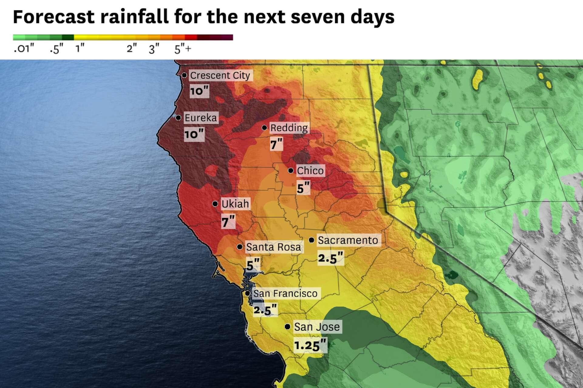
The approaching weather pattern suggests precipitation will likely commence during mid-week hours,with initial rainfall anticipated along coastal regions before spreading eastward. Mountain areas could experience more substantial accumulations, potentially receiving several inches of rain over a 24-to-36-hour period.
Current projections highlight varying intensity levels across different geographic zones. Coastal communities like San Diego and Los Angeles might experience intermittent showers, while inland valleys could encounter more consistent rainfall. Higher elevation areas, including San Bernardino and San Gabriel Mountains, stand to receive more significant precipitation.
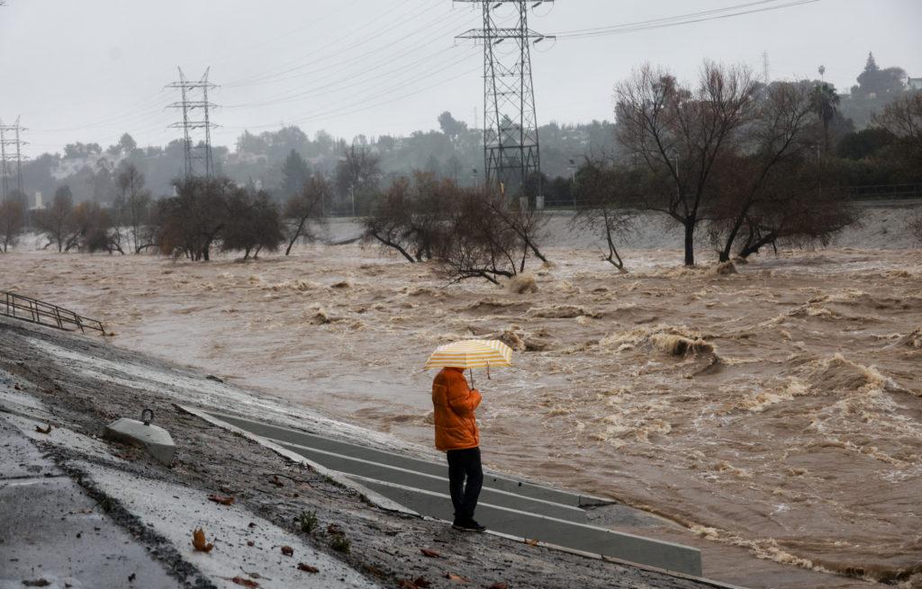
Local emergency management agencies recommend residents prepare for potential weather-related disruptions. This includes securing outdoor furniture, checking drainage systems, and maintaining emergency supply kits. Vehicle operators should exercise additional caution during rain events, anticipating potential roadway complications.Hydrological experts emphasize the critical nature of these precipitation events for regional water resources.Despite recent storms,Southern California remains significantly below historical average rainfall measurements. Each subsequent storm contributes incrementally to groundwater replenishment and reservoir levels.
Temperature ranges accompanying the incoming storm system are expected to remain moderate, with daytime highs hovering in the 55-65 degree Fahrenheit range. Nighttime temperatures could drop slightly, necessitating light jacket or sweater layers for outdoor activities.
Microclimatic variations might produce localized differences in rainfall intensity. Coastal regions typically experience more consistent precipitation, while desert-adjacent areas could see more sporadic rainfall patterns.
Agricultural sectors will closely monitor incoming precipitation, evaluating potential benefits for crop irrigation and soil moisture levels. Recent drought conditions have significantly impacted agricultural productivity, making each rainfall event increasingly significant.
Weather monitoring stations throughout Southern California will provide real-time updates, allowing residents to track storm progression and make informed decisions regarding outdoor activities and travel plans.
Residents are encouraged to stay informed through local meteorological services, utilizing multiple details channels to receive the most current and accurate weather forecasts during this anticipated precipitation event.